The ultimate goal of this project is the successful implementation by 2025 of a comprehensive plan to remove Spout Run from Virginia’s impaired waters list. The currrent objective is to use innovative multimedia communication tools as well as conventional approaches to: 1) Develop a locally supported management plan for the Spout Run watershed; and 2) Inform and inspire successful watershed planning processes in other Shenandoah Valley communities.
Spout Run is located in Clarke County, Va., and enters the Shenandoah River 33 miles above its confluence with the Potomac. The 14,000-acre watershed encompasses the broad spectrum of rural and urban land uses.
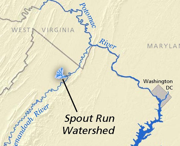
Spout Run Vicinity Map (click to enlarge)
Spout Run was first included on Virginia’s list of impaired waters in 1998. In February 2010, the state completed a Total Maximum Daily Load (TMDL) for sediment and bacteria in Spout Run, as well as for bacteria in two tributaries.To move toward delisting Spout Run and its tributaries, project partners have established a Stakeholder Steering Committee to guide delivery of a comprehensive range of outputs and outcomes during the two-year grant period…(more)